The Netherlands are internationally renowned for strong top-down spatial planning and compact city policy. However, when we see the results of 40 years of planning attempts in the Dutch metropolitan area, known as Randstad, one wonders what the hell happened in practice.
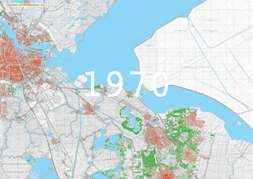
Amsterdam-Almere region: building a new town
The PBL institute recently launched a publication on New Towns and Suburban Development in The Netherlands, with a set of incredible urban growth maps.
At the end of the 1950’s, national politicians came to the conclusion that the cities Amsterdam, Rotterdam, The Hague and Utrecht were about to form a ring shaped metropolis, hence the name Randstad. Afraid of becoming a metropolis, like Paris (at the time apparently this was something awful), it was decided that the so-called ‘green heart’ would remain rural. To accomodate the demand for new housing in the 1970’s, a series of new towns were built along train connections near the major cities.
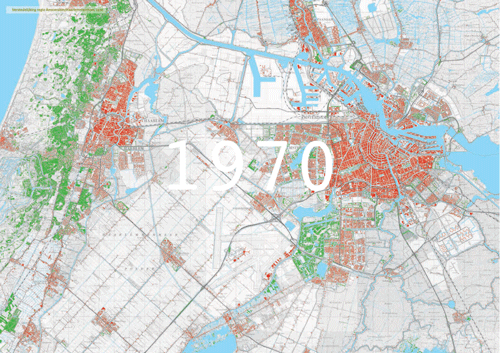
Amsterdam-Haarlem region: city expansion and the rise of Hoofddorp
Policies to use large locations near urban ring roads and highways for urbanization (Vinex, late 1980’s to early 2000’s) and the following ‘concentrated deconcentration’ – something almost inexplicable meaning as much as medium-density sprawl, did the rest. The result in the Randstad area over 40 years time, is an inversion of land use patterns. From a series of seperate cities in an agricultural setting, it became a suburban landscape, with islands of agriculture and recreational spaces. Does this mean The Netherlands as a whole are turning into a giant suburb? No, two thirds of the country still have agricultural use and especially the periphery of the country is not likely to experience strong urban growth.
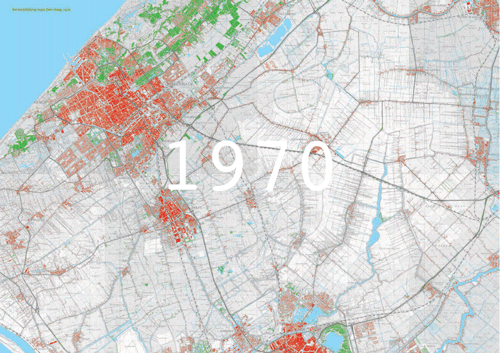 Haaglanden region: from separate towns to continuous urban field