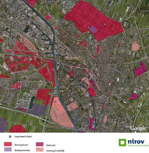
The Dutch “New Map” joins planning information of all municipalities in the Netherlands and gives a rather good idea of what the country will look like 10 years from now. Another project, called “The Old Map of the Netherlands”, gathered information on vacant lots and buildings.
When these two maps are put together, one finds that most vacant spaces are actually located outside the new development of housing, offices, commerce and leisure. This means that the potential of vacant space remains unused in Dutch urban planning. It also means there is still a bright future for squatting movements, just pick up the list and go…
Nirov Quickscan for the city Utrecht (searching for overlaps in the two maps, vacancy and urban development). Manon van Heusden en Jan Kadijk 23-06-08

Nirov Quickscan
www.nirov.nl/static/nieuws/Quickscan_OudeKaart_NieuweKaart.pdf
Nieuwe Kaart van Nederland (New Map of the Netherlands – new planning developments)
www.nieuwekaart.nl
Oude Kaart van Nederland (Old Map of the Netherlands – vacancy and possibilities for reuse)
www.oudekaartnederland.nl/okn.html