Köln waterfront

The riverfront is certainly one of the main urban axis of Köln (Cologne). Its main tourist attraction and landmark, the cathedral, as well as the central train station, are located close to the margins of the Rhine. The city harbor area, the Rheinauhafen, built in the 1880’s, has gone through a redevelopment process over the last decade. Based on a competition design of the 1990’s, construction on the 15 hectare site started in 2002. The middle of three ‘crane houses’ won a prize for best office development in 2009. With good weather, the walkway is a busy route for pedestrians and cyclists.

Redesigned riverfront walkway, view on railroad bridge

Köln Hauptbahnhof, staircase towards the cathedral

New residential developments at Rheinauhafen

View over the Rhine from Rheinauhafen

Walkway and ‘crane houses’

Inside MAS Antwerp

Museum aan de Stroom (MAS), meaning as much as riverside museum, is the new heart of a formal dock area and neighborhood called Eilandje (island) in Antwerp. The area went through a huge transformation over the last ten years, including intensification with apartment blocks, renovation of existing buildings and redesign of public spaces. Much of the prostitution and other remnants of the former harbor area are now gone.

The design of the museum, by Neutelings Riedijk, is marked by a public walkway that spirals its way up from the street to the roof level, giving the building its zigurat shape. This feature integrates public space with the building volume and brings visitors and neighbors in easy contact with the exhibitions. The walkway consists of spacious squares and escalators behind a curved glass curtain wall, through which different panoramas of Antwerp appear.

South view over central Antwerp

North view over harbor area and new residential developments

West view over the river Schelde and the Linkeroever (left bank)


Liège Guillemins

Between 2005 and 2009 a new high speed rail station landed in Liège (Belgium), a monumental design by Santiago Calatrava. The Guillemins station solved several infrastructural problems and provided the region of Liège and the Dutch region of Zuid-Limburg with access to the TGV-network. Surprisingly, the station also has direct access from the adjacent motorway. The huge terminal is an architectonic eye-catcher, attracting tourists and couples shooting wedding photographs. From the platforms, a wide panorama of the city can be observed, made possible by the longitudinal roof construction. The integration of the station with its surroundings however remains problematic.

Unlike the station of Leuven, Liège-Guillemins is situated as an island in an urban void and space of flows, with no urban development adjacent to it. The master plan, drawn up by Calatrava and Eurogare, foresees broad boulevards connecting the station with the waterfront of the Meuse river. In practice, not much of this connection has been realized yet. In fact, it is almost impossible to get directly from the station to the river, since an urban expressway blocks ones way, with very few options for pedestrian crossing.

As also observed by the Architectural Record, the large space in front of the station remains a desolate parking lot for the time being. Because of its scale and shape, the station also does not connect in any way to the existing neighborhood. The direct surroundings, including some rundown urban blocks with vacant lots and prostitution, will in time probably make way for realization of the master plan.
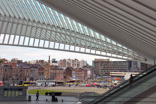
Surroundings of Liége-Guillemins

Meuse waterfront

Wonderland China

A very remarkable project by photographer Catherine Hyland, who explored an abandoned theme park at the urban fringe of Beijing. The original plan, to build a theme park bigger and more crowded than Disneyland, turned out to be a fantasy in itself. When the investors couldn’t come to an arrangement of land ownership with the local farmers, the plans were canceled and the construction site abandoned. Slowly, local residents of the village reoccupy these bizarre grounds. Read more at Atlantic City.
 

Utrecht panorama

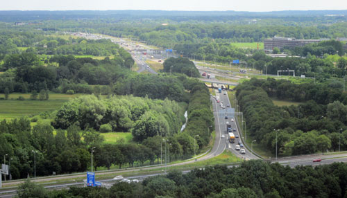
A view over Utrecht, The Netherlands, from the top floor of the provincial headquarters. Because of its central position, the busiest train station and intertwining of highways, the area is considered the hub of the country. Paradoxically, it is also one of the greenest regions, with moderate densities, as the pictures show.

West – historic center and railway station

East – national park and highway junctions

Northeast – Rijnsweerd, Uithof and Zeist