‘New’ space for the city

The discussion continues on whether Amsterdam can realize urban growth within existing urban areas or whether the city needs the proposed big-scale expansion locations at the artifical island of IJburg and near the 1970’s satellite-town Almere. Architects Tom Bergevoet and Maarten van Tuijl, of Temp Architecture, did a basic survey using Google Earth and found about 450 ha of vacant lots (red stains on the map) in Amsterdam, comparable to the IJburg project. Temporary use of vacant urban space for recreation, gardening and cultural events could make urban life more pleasant and prepare new sites like IJburg for urban occupation (phased development scheme below, in three steps). Politicians agree that a certain amount of vacant land and buildings is always needed to keep a city flexible and dynamic. However, a surplus of vacancy is thought to be unpleasant and unsafe.

ARCAM organizes debates with politicians, investors and entrepreneurs, on vacant buildings (May 18th 2011), and on vacant urban land (May 25th 2011). From May 11th, ARCAM hosts an exhibition by Temp, called New Space for the City.

Read More:
Urban Change – Amsterdam: densification or expansion (English)
Het Parool – In de stad ligt een IJburg braak (Dutch)

Nova Luz – an update

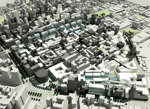
This month the urban plan for Nova Luz was presented. The plan encompasses the transformation of a large area (45 urban blocks, occupying 50 ha) close to the Luz railway station in central São Paulo. In the last decade, preparations for this plan have been made by the Municipality, including the construction of concert hall Sala São Paulo, recent plans for a new Opera designed by architects Herzog & de Meuron, and the polemic cleansing of ‘Cracolândia‘, an area dominated by drug traffic. In 2010 the city launched a tender for the urban plan of Nova Luz, which was won by a joint venture of Concremat Engenharia, Cia. City, Aecom Technology Corporation e Fundação Getúlio Vargas (FGV). In the next phases of Nova Luz, investors will need to be found to develop the individual lots. Due to the recent building boom in São Paulo, expectations are high.
A number of goals were set by the Municipality to be achieved in the plan:
– Reinforce the existing commercial function of the region, with special attention for the technology sector, represented by businesses around Rua Santa Ifigênia;
– Diversify residential profiles (different family types, singles etc.), in order to create a heterogeneous environment;
– Restore degraded and obsolete areas to increase living quality;
– Increase the amount of public space used for squares and social interaction;
– Improve the general conditions of mobility and infrastructure of the region;
– Restore architectural heritage, cultural and artistic works in the area;
– Create a social environment that promotes social and economic development.


New profile of Avenida Rio Branco

The winning project presupposes the redevelopment of around two thirds of the existing buildings, whereas one third is to be maintained and restored. The plan divides the area into five sectors:
1. Nébias – reinforcing the existing residential and hotel functions;
2. Corridor Rio Branco – turning the somewhat fragmented avenue into a dense urban boulevard, served by public transport, with large office buildings on top of a retail base level;
3. Triunfo – creating a diverse residential area, with library, school, kinder-garden and services;
4. Nova Luz Culture and Entertainment area – transforms the direct surroundings of the station, mainly sheds and parking lots, into a leisure area;
5. Technological area – attracting lead technology businesses through tax incentives.


Triunfo sector – school and public space

Architectonic ambitions are high, judging by the illustrations of the plan. Buildings interact with the urban environment at ground level and have lively balconies and openings in the facades. Public space is very green and attractive, compared to earlier urban operations in the city such as the Berrini Avenue. A few observations have to be made:
Firstly, the project merely provides volumetric studies of the area and does not determine the exact urban form of the developments at this stage. Individual developers will offer their projects in following tenders. In the past, this has not always led to a desirable urban form and architectural quality in São Paulo. Developers tend to emphasize safety and privacy aspects, instead of interaction of the building with the street, as they fear that the building won’t sell if it is made too transparent and accessible. If investors don’t commit to the architectural ambitions of the urban plan, or when supervision of the plan fails, the quality of the whole plan is at stake.
Secondly, the quota of social housing units in the plan, as fixed in the Zeis municipal land use plan, must still be implemented through tenders. As this segment is less profitable than other types of dwellings, the social housing units tends to be unattractive for investors. Strict rules for mixed developments and application of fines when social housing is not delivered, could help to encourage the fast implementation of social housing in the area.


Sala São Paulo concert hall by night

Many of the buildings on the list to be demolished, have a social housing function today. NGO’s like Fórum Centro Vivo have been concerned with the current population and small businesses in the Nova Luz area, threatened by increasing real estate values and gentrification. In 2008, the NGO organized an informal night walk through Nova Luz with lanterns, Traga sua Luz, to point out the effects of demolishing in the area. Less than two years later, the offical Nova Luz project office organizes another night walk to show the beauty and potential of the cultural district, near the Luz train station. However, the photo report of the excursion shows mostly well known historic buildings situated outside the Nova Luz area, such as Teatro Municipal.

Read more:
Nova Luz SP project office
Nova Cracolândia (Portuguese)
Nova Luz in 2007 (Portuguese)

Monopoly

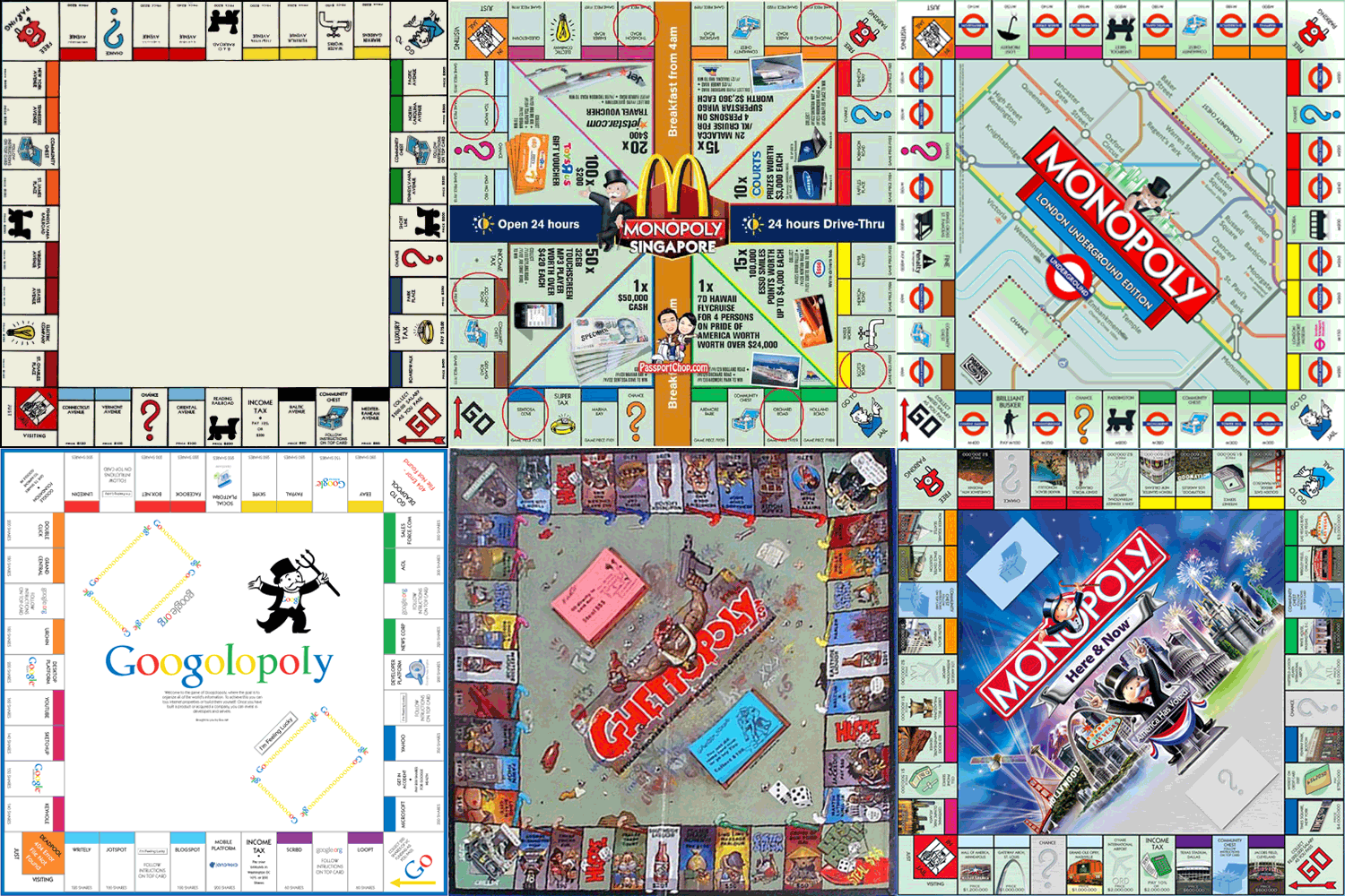
The Monopoly game shows us that for over a century, the economic system behind land ownership has remained more or less the same in the western world. Each time we lose a monopoly game we realize how difficult it is to become an important player when you have only few properties in town, except when you´re extremely lucky on the dice. Each time we win, we understand how it really works well to be a monopolist –  of any kind in any place, be it in real estate, the fast food industry, nightlife, in New York, São Paulo or Manchester. Money you invest in land will bring you more money, while those who rent pay the bill. During economic crises however, these rules are turned upside-down.

Monopoly was based on the Landlord´s Game, a board game made in 1904 by Elizabeth Magie. She built the game according to the principles of Henry George, who stated that in essence all wealth comes from land ownership and that this should therefore be the main source of tax revenues in a fair society. Magie used the game to demonstrate how rents enrich property owners and impoverish tenants. The consciousness of  this ongoing injustice would eventually encourage citizens to change the economic system, she thought. In the following hundred years, the Monopoly game has dominated the world, apparently without provoking such effects. In 1935 she sells the game patent to the Parker brothers. Shortly after the financial crisis of 1929, the emblematic game became an instant commercial success. Similar games were developed at the same time, such as Finance, in 1932.

The well-known game board of New York still featured places like the Boardwalk, which would become abandoned realty failures only a few decades later. Newer game boards feature boom-towns like Hollywood and Las Vegas. Shortly after the oil crisis in the seventies, an Anti-Monopoly game was brought out by professor Ralph Anspach (San Fransisco University). In this game, the initial situation was in fact a monopoly, whereas the players had to try and return to a free market situation during the game. Numerous other -opoly games were made throughout the years, including Ghettopoly, a version dealing with Harlem and other delicate neighborhoods, which was considered shocking and racist. Recently, a Monopoly Recession Edition was launched, describing the collapsed real estate market of 2009, marked by foreclosures and bankruptcies. Fast Food Franchise is about becoming a snack food tycoon, while Rua Augusta monopolizes bars and night clubs in a popular leisure area of São Paulo. After urban space, the game format has recently been used to play competition and domination in cyberspace, for example in Googolopoly and Blogpoly.

Instant Port-au-Prince

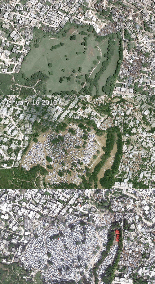
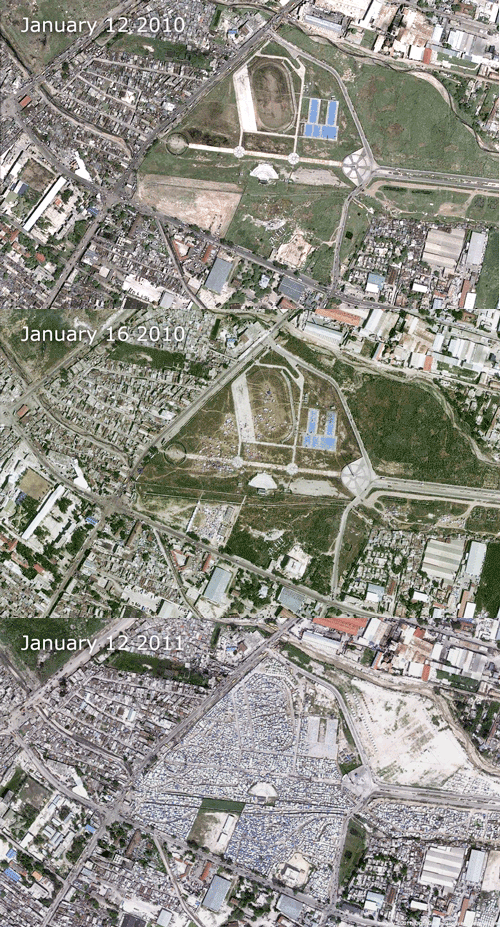
As usual, Lebbeus Woods’ weblog is featuring stunning topics: the sudden rise of informal settlements in Haiti’s capital Port-au-Prince, due to the societal collapse after the earthquake. For example, a golf course instantly turns into a refugee site with hundreds of tents. The same happens in the case of an airport. The original material can be accessed through an interactive map at the New York Times website.
The current floods in Brisbane, Australia, are also being shown in a similar way by aerial photos before and after the disaster at ABC news.

Sphinx

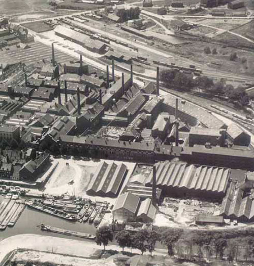
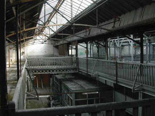
In 2004, the city of Maastricht approved the Belvédère master plan, concerning the grand scale redevelopment of an old industrial area, at the fringe of the old city center. The site is characterized by the old Sphinx factory (porcelain and ceramic products), as well as the central dock, where ships used to unload raw materials and load manufactured goods. Sphinx was founded in Maastricht in 1834 and its new owner, a Finnish businessman, ended activities in Maastricht in 2010.
The industrial complex intersects with two main urban structures of 19th century Maastricht: the military defense walls, surrounding the city, and the Willemsvaart, a major transport canal for importing and exporting goods. In the remaining buildings, several innovative building techniques of the industrial age were incorporated in an early stage, such as the reinforced concrete structure of Hennebique and one of the first glass curtain walls.

The master plan affirms Maastricht as a compact city in an open landscape. This means the Belvédère site is one of the last areas for large scale urban projects. The transformation will take between 20 and 25 years and will cost around 1,3 billion euros. The municipality has signed a joint venture for the investments with ING Real Estate and BPF, among smaller corporations. In the plan, there is a focus on new dwellings, offices and cultural program. In the light of the current European real estate crisis, these ambitions are likely to be altered or delayed.

One of the icons in the industrial site is the Carpenter’s Workshop. The transformation of this old structure to give it an important cultural function is supposed to boost the cultural infrastructure of Maastricht. The complex shelters a cultural movie theater, studios for practice purposes and a performance theater for the Huis van Bourgondië, a workshop for music production house Intro-In Situ, a practice space for Toneelgroep Maastricht, a cultural café, a restaurant, lobbies and office space, space for urban music and events, a theater room with 400 chairs, artist lobby and technical space, and a bicycle garage.

Read more:
Report on the historic value of the Sphinx complex (Dutch)
Discover the Sphinx area Maastricht and its main buildings in Google Maps