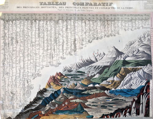
I found this neat historical drawing in the Rotterdam Public Library, as part of a small exhibition on cartography (objects and maps borrowed from Delft University of Technology). The drawing compares the longest rivers, highest mountains and deepest waterfalls on earth by placing them all in the same view. Something we would today call an infographic.
