Lemonopoly

The online game Lemonopoly was launched in the San Fransisco bay area, a region traditionally rich in citrus fruit. Unfortunately, lots of fruit goes to waste. The game challenges tree owners and residents to make better use of the fruit, sharing it and making things from lemons, limes and oranges, such as lemonade or marmalade. As such, scoring in the online game promotes a new social citrus culture in the real city. In July this year, the game will be fully functioning, providing a point system for sharing lemons, adding trees to the map and making things with citrus fruit.

Metropoolforum 2012

Tuesday May 29th, the Deltametropolis Association organizes Metropoolforum 2012, at the Louis Hartlooper Complex in Utrecht.

In this forum, everyone can participate in the metropolitan debate, and discuss ideas of how the Dutch metropolis should be developed. There will be short presentations by experts, stakeholders and association members. Three main themes will be addressed:

1. New metropolitan strategies

2. How big is the metropolis?

3. Bottom-up urban integration

Supermart

Last autumn, the Breda Museum of the Image featured an exhibition called Supermart.

The exhibition, made up off selected products from the supermarket, is a certain homage to the typical marketing of everyday products by colorful packaging. Some aspects of grocery marketing have changed a lot since supermarkets exist, especially the shape of bottles and use of typography. Other ideas remain rather constant: current tomato soup cans are very similar to the  1962 design for Campbell’s soup by New York artist  Andy Warhol. And for some reason, lemon juice bottle designers have always been inspired by the shape and texture of lemons.

At the same time, the all too familiar groceries give a strange feel to the space, because they are not ordered according to product categories or supermarket departments. Instead, they are arranged graphically, by color.

Leuven CS

In central Leuven, two major areas are in the process of urban transformation: the surroundings of Leuven Central Station and the fluvial port area, called Vaartkom.


open large map of Leuven CS and Vaartkom

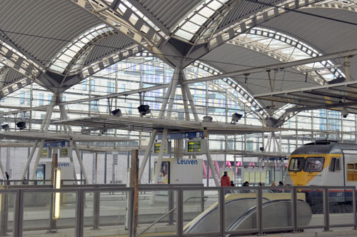
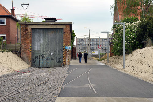
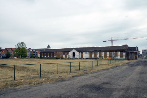
The construction of the new station square and bus terminal, by Spanish architect Manuel de Solá-Morales, has changed the entrance of the city for who arrives by public transport. The urban plan by Marcel Smets (professor at Leuven University) has intensified land use on the center side of the railway zone, and has connected the center of Leuven with the town of Kessel-Lo through a passageway underneath the station. The station itself was improved by a new canopy and parking garage. The old station building is being renovated at the moment. In the design, optimal use was made of the existing levels around the station, to separate pedestrian traffic from road traffic and create attractive public space. At the Kessel-Lo side, development continues. Nearby, at a former locomotive manufacturing site, a large urban void waits for redevelopment. The Vaartkom area is starting transformation of historic warehouse buildings along the dock.

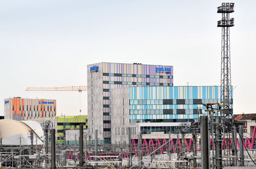
Development of hotels and offices at the Kessel-Lo side of Leuven CS

Development of offices at the center side of Leuven CS

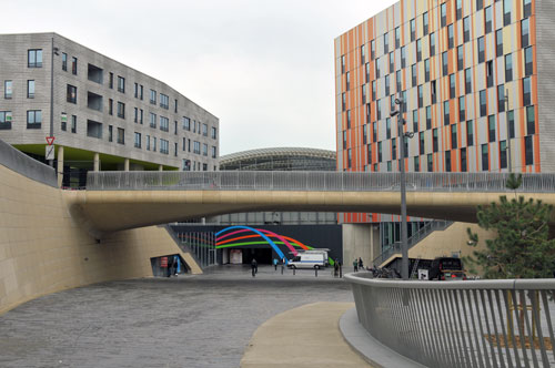
Kessel-Lo entrance of Leuven CS

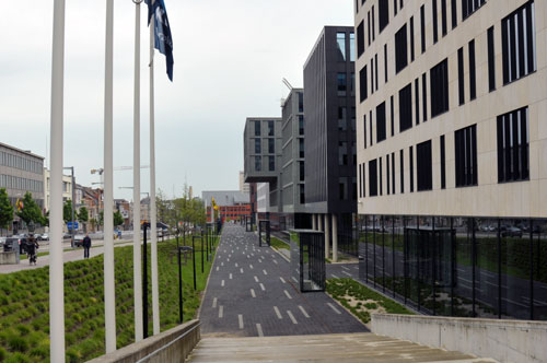
New walkway connecting Kessel-Lo to Leuven CS

Vacant space of the former locomotive factory at he Kessel-Lo side

Tokyo corridors

Friday May 25th, Paul Chorus will defend his PhD thesis at the University of Amsterdam:

‘Station area developments in Tokyo and what the Randstad can learn from it’

The research analyzed how station areas are being planned in Tokyo and what roles public and private stakeholders have in this process. Ideas were gathered about how to improve station area planning in Randstad Holland. For example, by adequate legislation on land use and a prominent role for regional governments in distributing key urban programs along metropolitan rail corridors. Unlike the Netherlands, Tokyo uses building density around transit stations as an important planning instrument. Additional floor area bonuses are given to developers, who create a certain amount of public space on the ground level of their plot.

Tokyo is an extraordinary example of a rail-oriented city. With the extensive network in the region of 36 million people, large part of the population lives within 10 minutes walking distance from a station

Detail from the Greater Tokyo transit map. Click here to download the full map.

“Within a railway corridor different functional profiles can be distinguished:
In general, the urban sub centres situated at the beginning and/or end of the line (Shibuya and Yokohama) tend to be dominated by offices and retail. In between these sub centres a variety of functional profiles can be found. Interestingly the most multifunctional stations tend to be located somewhere in the middle of the line, such as Jiyugaoka and Musashi Kosugi on the Toyoko line. First and foremost this is caused by the business strategy pursued by Tokyu Corporation.
The core of its growth strategy focuses on creating synergies between its transport, real estate and retail departments. By placing activities (e.g. shopping malls, universities, hospitals and offices) somewhere in between the line bi-directional and off-peak travel can be promoted. Consequently, a more efficient railway operation can be realized. In addition, such activities can lead to more customers and consequently increased sales. And last but not least, the development of attractive facilities will have a positive influence on the surroundings of a station, illustrated by the increased land and rent prices.”