Tokyo corridors

Friday May 25th, Paul Chorus will defend his PhD thesis at the University of Amsterdam:

‘Station area developments in Tokyo and what the Randstad can learn from it’

The research analyzed how station areas are being planned in Tokyo and what roles public and private stakeholders have in this process. Ideas were gathered about how to improve station area planning in Randstad Holland. For example, by adequate legislation on land use and a prominent role for regional governments in distributing key urban programs along metropolitan rail corridors. Unlike the Netherlands, Tokyo uses building density around transit stations as an important planning instrument. Additional floor area bonuses are given to developers, who create a certain amount of public space on the ground level of their plot.

Tokyo is an extraordinary example of a rail-oriented city. With the extensive network in the region of 36 million people, large part of the population lives within 10 minutes walking distance from a station

Detail from the Greater Tokyo transit map. Click here to download the full map.

“Within a railway corridor different functional profiles can be distinguished:
In general, the urban sub centres situated at the beginning and/or end of the line (Shibuya and Yokohama) tend to be dominated by offices and retail. In between these sub centres a variety of functional profiles can be found. Interestingly the most multifunctional stations tend to be located somewhere in the middle of the line, such as Jiyugaoka and Musashi Kosugi on the Toyoko line. First and foremost this is caused by the business strategy pursued by Tokyu Corporation.
The core of its growth strategy focuses on creating synergies between its transport, real estate and retail departments. By placing activities (e.g. shopping malls, universities, hospitals and offices) somewhere in between the line bi-directional and off-peak travel can be promoted. Consequently, a more efficient railway operation can be realized. In addition, such activities can lead to more customers and consequently increased sales. And last but not least, the development of attractive facilities will have a positive influence on the surroundings of a station, illustrated by the increased land and rent prices.”

SprintCity at BUFTOD 2012

This week we presented SprintCity, a project by the Deltametropolis Association in cooperation with TUDelft and Movares, at the BUFTOD conference in Paris (Marne-la-Vallée). SprintCity investigates opportunities for transit-oriented development (TOD) in The Netherlands, using a simulation game toolkit based on real data, with the real stakeholders. Besides sharing results of this project so far with urban planners, the goal of the presentation was to discuss whether this planning support tool can be effectively implemented in other regions and city’s. Fortunately, the international community gave a very good response to the project and suggested fruitful applications in the city regions of Toulouse, Paris, Bogotá, Alicante and the central plain of Mexico. Hopefully, a couple of these applications can actually happen over the next year. Click here to download the SprintCity folder (English).

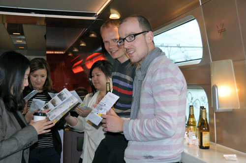
The BUFTOD 2012 conference joined several international researchers and planners. There was a certain Eurocentric perspective, followed by North America and Asia. Although some of the efforts were ‘lost in translation’, in general it was a good opportunity to build a TOD network. The Dutch were extremely well represented, with several universities and case studies. I took a Thalys train with Dutch researchers from the University of Amsterdam and Delft University of Technology.

Dutch TOD specialists on their way to Paris
International good practices were compared, contributing to better understanding of different development models and the specific conditions that led to these strategies in each country. It became clear once again, that ready-made solutions (prêt-a-porter) don’t exist. However, we can learn of how each case has managed to remove a barrier to TOD. A few notes:

Robert Cervero, a known authority in the field of TOD, mentioned the importance of organized density (Curitiba) in contrast to scattered density (São Paulo); the potential of functional mix and re-use of brown-field sites and industrial complexes near transit stations (Dallas, Seattle); and high integration of Bus Rapid Transit systems with surrounding development (Guangzhou) versus low integration (Bogotá). Cervero was rather surprised with the critical Dutch projects at the conference, since the Dutch slow traffic and public transport systems generally serve as good examples abroad.
Claude Soulas showed the Port-Vert project in Noisy (Marne-la-Vallée), about inter-modality around the regional RER train system. Currently, the bicycle feeds 1,8% of these metropolitan trains, whereas the best European practices reach 40-50% of bike pre-transport to railway stations. Furthermore, the functional mix of greater Paris needs to be improved, as the East is predominantly residential and the opposite side around La Défense concentrates a huge amount of jobs.

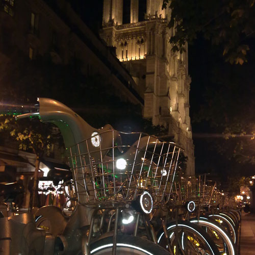
Rental bikes, in front of the Notre Dame cathedral
Adrien Gey presented a circular slow traffic network in the Grand Paris region, connecting various parks and natural sites to housing and work areas. Guowen Dai demonstrated some of the challenges around the new high-speed South Station in Nanjing. An area of 32 square kilometers should become a ‘new town’ of 60.000 people. However, current urbanization has not occured according to the master plan, and integration of the station with metro and road networks will be challenging. Wendy Tan showed that TOD projects all over the world keep track of each other and sometimes copy-paste design solutions from other contexts into their own.
Maria Palumbo analyzed the motor-taxi system in Cotonou (Benin), which is starting to evolve into a formal system by recognizable yellow driver t-shirts. The Cotonou model is being exported to other cities in the West-African region, such as Bamako in Mali. Armando Padilla investigated TOD implementation possibilities in the Alicante province and Murcia region, according to the Dutch Stedenbaan experience. The polycentric region suffers from sprawl and the real estate crisis, which makes improvement of rail transport very challenging.

Juliette Maulat presented metropolitan density targets for a rail corridor west of Toulouse. Between 2000 and 2010 the frequency of the service was raised to 4 trains per hour, leading to an increase in ridership. However, the improvements on the transport system merely supported urban development, and did not shape them to the desired densities. Paul Chorus demonstrated that the Tokyo metropolitan government regulates density and public space around transit stations by granting higher floor area ratios to developers. Transit companies develop diverse activities along a corridor to create off-peak travel and make more profit. The companies gain life-time concessions and thoroughly investigate their territory and residents to optimize revenues.
Elina Krasilnikova and Yulia Ivanitskaya presented the longitudinal industrial city of Volgograd (Stalingrad), with 100km length and 9km width one of the longest cities in the world. A new waterfront transport axis could initiate redevelopment of the industrial sites along the river and make place for a linear park and leisure facilities. Wulfhorst and Alain L’Hostis discussed the German-French collaboration project Bahn.Ville, which was directed at integration of transport and spatial planning at two reference sites: St. Etienne and Thaunusbahn (Frankfurt). Implementation of TOD in Saarterassen, near the French-German border, is still difficult due to sectoral responsibilities and lack of an integrated lobby agent for TOD. Despite these setbacks, they have the following advice: ‘Don’t Wait! The time is now, the place is here! Start testing implementation of TOD right away.’

Photograph of Volgograd, taken from the International Space Station

Read more:
SprintCity planning support tool in Utrecht
Atlanta BeltLine – lecture, debate and booklet
SprintCity – spring 2011

Hong Kong public transport nodes
SprintCity goes China

New rules, new game?

The traditional land use plan in the Netherlands does not fit the needs of current times anymore

That was the statement behind a debate, organized by Stroom, Deltametropolis Association and the Netherlands Architecture Fund, on the 1st of March 2012. Just before the debate, an exhibition was inaugurated in Stroom, about the same theme, titled New Space for the City.

The debate and exhibition challenge the traditional technocratic planning mechanisms and state that more should be done to include small players on the real estate market and temporary projects, which nowadays run through the same approval procedures as other projects. Due to the real estate crisis in Europe, investors and other big players have stopped building, so the small and temporary could be a way out. It is suggested that some urban areas can still be developed under existing land use planning. Others, however, demand a new approach, ranging from ‘laissez-fair’ to certain laws that promote transformation of vacant office space into much needed housing. Other possibilities are City Dressing (wrapping of facades), Urban Pioneers (bottom-up community initiatives) and Unbuild City (partly demolish obsolete complexes to promote reuse). According to the architects Maarten van Tuijl and Tom Bergevoet, from the office Temp.architecture, this means that Dutch planning policy would be separated in two different spheres: traditional and flexible.

In The Hague, several areas would benefit from more flexible legislation, such as the Petroleum docks, Laakhaven and Binckhorst. A legal advisor of the city of The Hague, Maarten Engelberts, explains that already within the existing laws, ways can be found to make small housing developments possible in areas that were earlier blocked by environmental constraints. The constraints that are not actually being used, for example by a polluting factory, could be excluded from new and flexible land use plans.

Edward Stigter, of the Ministry of Infrastructure and the environment, explains the project ‘Eenvoudig Beter‘ (Simply Better) that is coming about. It includes a full review of planning law, with the objective of merging environmental and land use policy. Besides ‘simpler and better’, by the way, it also needs to be cheaper, he says. The new legal framework should, according to European guidelines, focus on places and areas, integrating all necessary aspects in one law; and it should provide maximum flexibility and opportunities for development. This new package deal is to be called ‘Omgevingsverordening’ instead of the old ‘Bestemmingsplan’.

A number of statements were then discussed by the panel, consisting of Jan Struiksma (chairman of the Institute for Building Law), Duco Stadig (H-Team), Edward Stigter (Simpler and Better, IenM), Johan Houwers (in Parliament representing VVD) and Wil van der Hoek (Director Housing, municipality of The Hague), for example:

> Organic Growth: growing from a temporary activity to a permanent one is not sufficiently supported by current land use plans

> Reviewing the Social Contract: individual rights and ample demand for legal security by citizens have made urban development too expensive and slow

Most panel members agreed that new legislation is indeed required. Only Struiksma stated that rules will not change the game, it will only lead to more delay, since each player needs to familiarize himself again with the new rules. Furthermore, what really prevents Dutch society from building, is lack of money, he said.

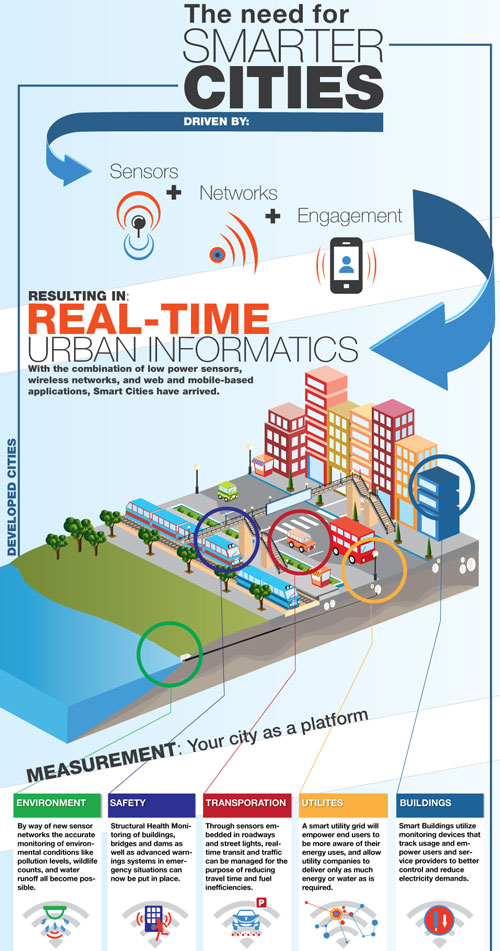
Anatomy of a smart city

“The dramatic shift of the world’s population into urban areas is encouraging citizens, city planners, businesses and governments to start looking at visions of ‘smart’ cities.”

Since the rise of the smart phone and the idea that we’ll be living mainly in an urban world from now on, urban network applications have mushroomed increasingly. Not only can we plan our mobility patterns with transit and route planning apps, also can we monitor our energy consumption, municipal services and proximity of friends and relevant places.

A few examples:

> The Mobile City has organized various events on mobile applications of social networks and public engagement in urban systems, such as Social Cities of Tomorrow (2012).

> The municipality of Amsterdam launched a google maps application that lists vacant spaces and buildings. Each object has a list of information for possible new (temporary) users, explaining what kind of activities the municipality would like to have there, who is the contact person, area and pavement type etc.

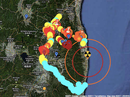
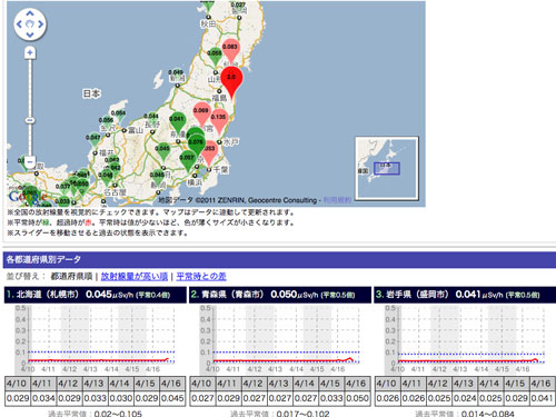
The Japanese website Geigermaps has bundled information on radioactivity, measurements with Geiger counters and map applications providing information of radioactivity to the population. Shortly after the Fukushima accident the initiative was widely adopted.

Postscapes collects new ways to make our cities smarter, using sensors, networks and engagement.


Retirement cities

September 2011, Susana Alves and Merten Nefs will present a paper at Environment 2.0, a conference organized by Technical University Eindhoven. The paper discusses the possibilities for Shrinking Cities to attract elderly by spatial features and services and transform their economy to focus on leisure and health care – in other words, to become successful Retirement Cities.


Retirement Cities – Analysing the opportunities and challenges of a co-existence of ageing and urban shrinkage in Europe

Authors:
Merten Nefs (Deltametropolis Association, Rotterdam)
Susana Alves (Edinburgh College of Art; OPENspace Research Centre)
Ingo Zasada (Leibniz Centre for Agricultural Landscape Research Institute of Socio-Economics, Müncheberg)
Dagmar Haase (Humboldt University Berlin and Helmholtz Centre for Environmental Research – UFZ, Leipzig)

ABSTRACT
Urban shrinkage has been acknowledged a major trend in many urban regions across Europe and elsewhere. Increasingly, policy makers and planners have been developing strategies to cope with these new urban development paths and their socio-spatial consequences. The authors advance the idea that active retirement migration and health tourism can be part of such strategies and ask the question: What are opportunities but also challenges for retirement migration in shrinking European cities? The authors, all from different disciplines and countries, share the idea that retirement migration and urban shrinkage in Europe are connected, bound together by the search for urban ‘quality of life’. Both processes have already been discussed extensively as separate subjects in academic literature. However, in this paper a conceptual model is proposed, which provides an approach of how to assess the suitability and identify development perspectives of shrinking cities in the context of an aging society and the in-migration of retirees. Based on two carefully selected case study regions with particular relevance of aging population – Walcheren (NL) and Leipzig (GER) – the conceptual model is exemplarily applied to investigate both quantity and quality of green open spaces and living environment, a major aspect in urban quality of life. It is argued, that shrinking cities provide valuable opportunities to adapt to the affordances of an aging population. Retirement in-migration again might represent a crucial catalyst in urban renewal for shrinking cities.

Walcheren – retirement at the North Sea coast, in a region facing shrinkage


Leipzig – reuse of urban green space in a shrunken city, for recreational use and active ageing