Metropoolforum 2012

Tuesday May 29th, the Deltametropolis Association organizes Metropoolforum 2012, at the Louis Hartlooper Complex in Utrecht.

In this forum, everyone can participate in the metropolitan debate, and discuss ideas of how the Dutch metropolis should be developed. There will be short presentations by experts, stakeholders and association members. Three main themes will be addressed:

1. New metropolitan strategies

2. How big is the metropolis?

3. Bottom-up urban integration

Leuven CS

In central Leuven, two major areas are in the process of urban transformation: the surroundings of Leuven Central Station and the fluvial port area, called Vaartkom.


open large map of Leuven CS and Vaartkom

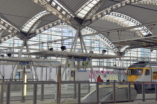
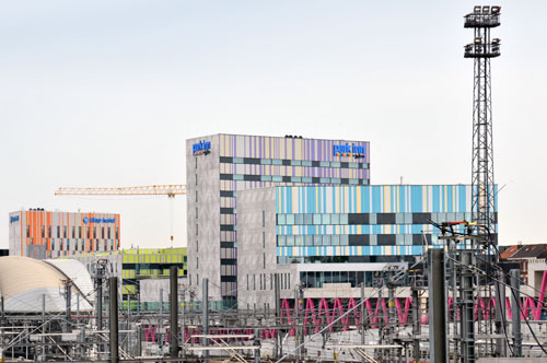
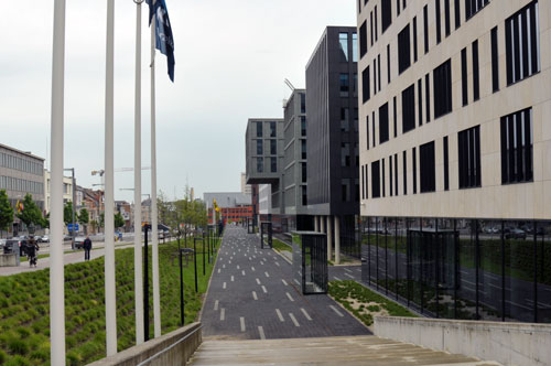
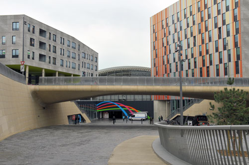
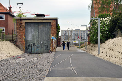
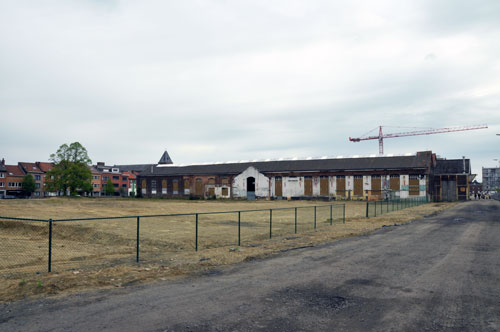
The construction of the new station square and bus terminal, by Spanish architect Manuel de Solá-Morales, has changed the entrance of the city for who arrives by public transport. The urban plan by Marcel Smets (professor at Leuven University) has intensified land use on the center side of the railway zone, and has connected the center of Leuven with the town of Kessel-Lo through a passageway underneath the station. The station itself was improved by a new canopy and parking garage. The old station building is being renovated at the moment. In the design, optimal use was made of the existing levels around the station, to separate pedestrian traffic from road traffic and create attractive public space. At the Kessel-Lo side, development continues. Nearby, at a former locomotive manufacturing site, a large urban void waits for redevelopment. The Vaartkom area is starting transformation of historic warehouse buildings along the dock.

Development of hotels and offices at the Kessel-Lo side of Leuven CS

Development of offices at the center side of Leuven CS

Kessel-Lo entrance of Leuven CS

New walkway connecting Kessel-Lo to Leuven CS

Vacant space of the former locomotive factory at he Kessel-Lo side

Tokyo corridors

Friday May 25th, Paul Chorus will defend his PhD thesis at the University of Amsterdam:

‘Station area developments in Tokyo and what the Randstad can learn from it’

The research analyzed how station areas are being planned in Tokyo and what roles public and private stakeholders have in this process. Ideas were gathered about how to improve station area planning in Randstad Holland. For example, by adequate legislation on land use and a prominent role for regional governments in distributing key urban programs along metropolitan rail corridors. Unlike the Netherlands, Tokyo uses building density around transit stations as an important planning instrument. Additional floor area bonuses are given to developers, who create a certain amount of public space on the ground level of their plot.

Tokyo is an extraordinary example of a rail-oriented city. With the extensive network in the region of 36 million people, large part of the population lives within 10 minutes walking distance from a station

Detail from the Greater Tokyo transit map. Click here to download the full map.

“Within a railway corridor different functional profiles can be distinguished:
In general, the urban sub centres situated at the beginning and/or end of the line (Shibuya and Yokohama) tend to be dominated by offices and retail. In between these sub centres a variety of functional profiles can be found. Interestingly the most multifunctional stations tend to be located somewhere in the middle of the line, such as Jiyugaoka and Musashi Kosugi on the Toyoko line. First and foremost this is caused by the business strategy pursued by Tokyu Corporation.
The core of its growth strategy focuses on creating synergies between its transport, real estate and retail departments. By placing activities (e.g. shopping malls, universities, hospitals and offices) somewhere in between the line bi-directional and off-peak travel can be promoted. Consequently, a more efficient railway operation can be realized. In addition, such activities can lead to more customers and consequently increased sales. And last but not least, the development of attractive facilities will have a positive influence on the surroundings of a station, illustrated by the increased land and rent prices.”

Paris – a visit to the railroads

Paris has been an inspiring test site for everything connected to rail transport, stations and ‘transit oriented development’. One can find good functioning ‘gares’, traditionally from the nineteenth century, such as Gare St. Lazare and Gare du Nord. The seven terminal station buildings were completely integrated in Paris’ classic street pattern and boulevards. One of the stations, Bastille, was demolished later on. Some stations are located very close to one another, such as Gare du Nord and Gare de l’Est, and Gare de Lyon and Gare de Bercy. However, each has distinct destinations in France and abroad.

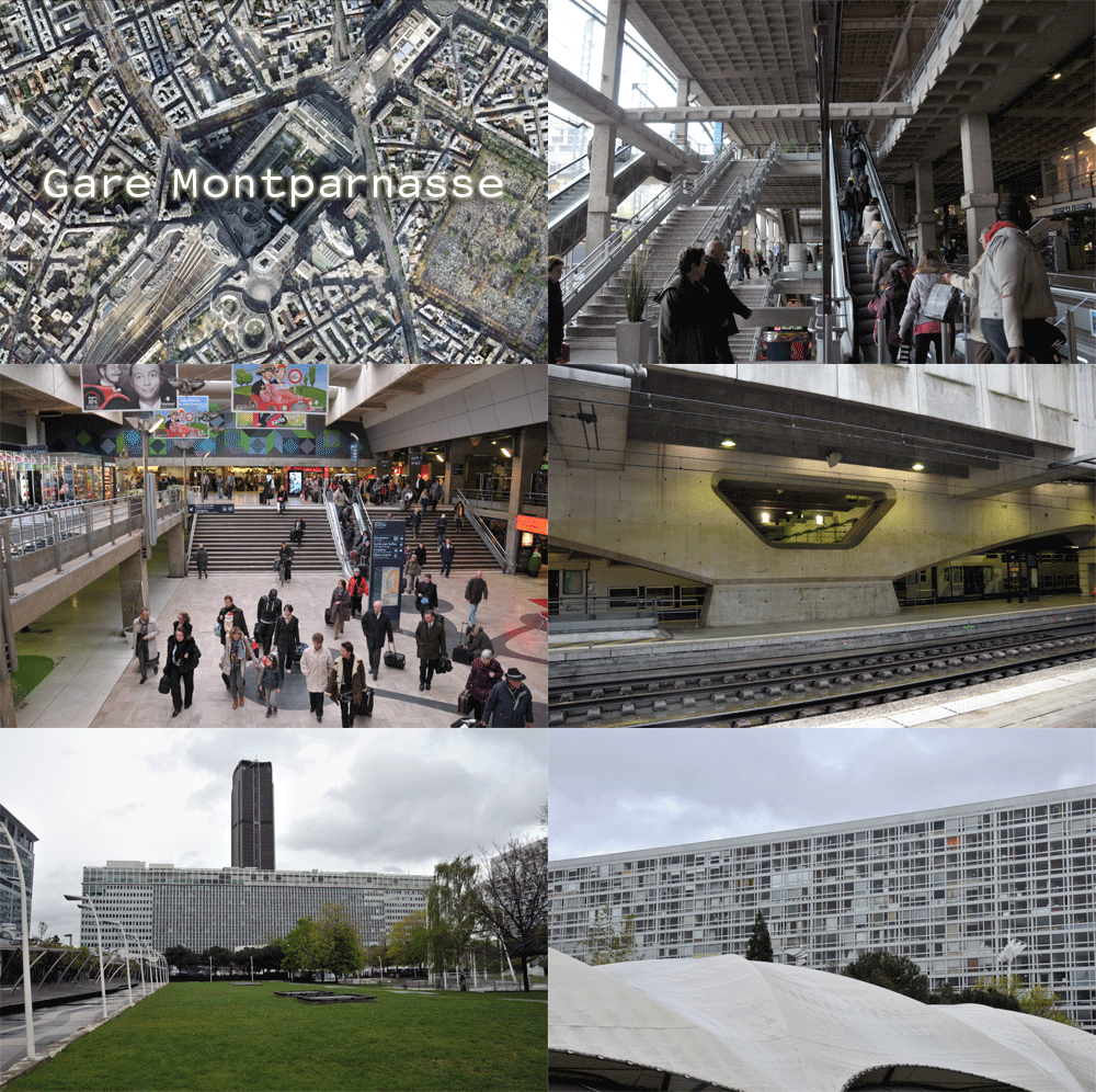
Gare Montparnasse set the scene for one of the most iconic train accidents in history. In 1895, a locomotive burst through the main facade, after having trouble with dis-functioning breaks. The station was completely rebuilt in 1969, establishing a heavy green deck on top of the platforms, with trees, event spaces and tennis courts. The square is flanked by enormous modernist buildings on three sides, and one of Paris’ highest office towers.

In suburban districts, such as Marne-la-Vallée, regional RER stations are integrated with social housing, shopping centers and extensive parking facilities. The surroundings of station Noisy Le Grand, for example, are dominated by roads and drive-ins, while the RER station itself is situated underground. Postmodernist architect Bofill realized several buildings in this area, such as the housing complex below.

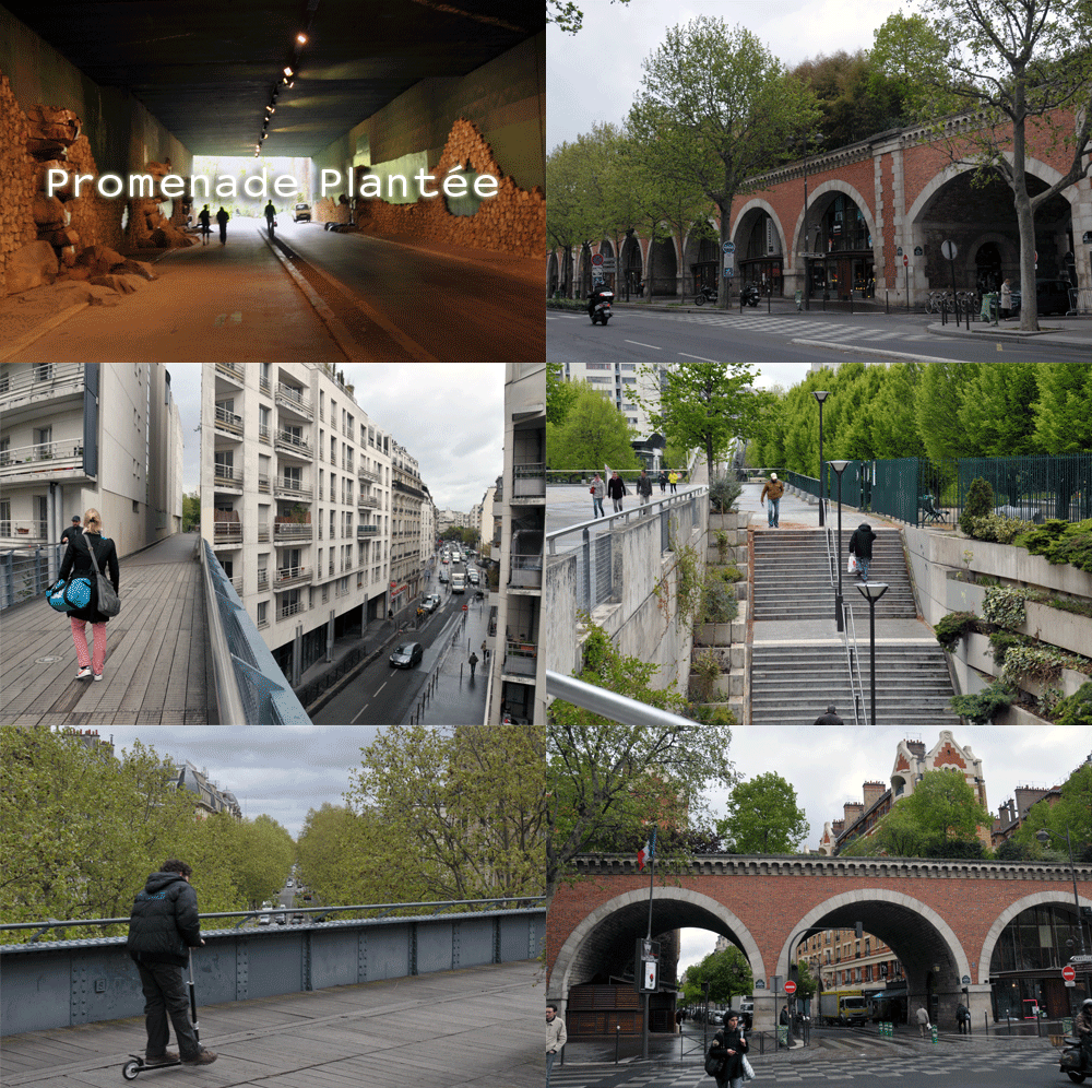
The Promenade Plantée is an early example of reuse of an obsolete railroad viaduct. It was refurbished as an elevated park in the 1980’s and 1990’s and has since that time propelled revitalization of the adjacent neighborhoods. The trail consists of both elevated and street level sections, as well as a tunnel section. It has served as an example for many other transformation projects, such as the New York High Line.

SprintCity at BUFTOD 2012

This week we presented SprintCity, a project by the Deltametropolis Association in cooperation with TUDelft and Movares, at the BUFTOD conference in Paris (Marne-la-Vallée). SprintCity investigates opportunities for transit-oriented development (TOD) in The Netherlands, using a simulation game toolkit based on real data, with the real stakeholders. Besides sharing results of this project so far with urban planners, the goal of the presentation was to discuss whether this planning support tool can be effectively implemented in other regions and city’s. Fortunately, the international community gave a very good response to the project and suggested fruitful applications in the city regions of Toulouse, Paris, Bogotá, Alicante and the central plain of Mexico. Hopefully, a couple of these applications can actually happen over the next year. Click here to download the SprintCity folder (English).

The BUFTOD 2012 conference joined several international researchers and planners. There was a certain Eurocentric perspective, followed by North America and Asia. Although some of the efforts were ‘lost in translation’, in general it was a good opportunity to build a TOD network. The Dutch were extremely well represented, with several universities and case studies. I took a Thalys train with Dutch researchers from the University of Amsterdam and Delft University of Technology.

Dutch TOD specialists on their way to Paris
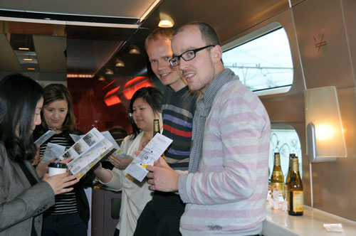
International good practices were compared, contributing to better understanding of different development models and the specific conditions that led to these strategies in each country. It became clear once again, that ready-made solutions (prêt-a-porter) don’t exist. However, we can learn of how each case has managed to remove a barrier to TOD. A few notes:

Robert Cervero, a known authority in the field of TOD, mentioned the importance of organized density (Curitiba) in contrast to scattered density (São Paulo); the potential of functional mix and re-use of brown-field sites and industrial complexes near transit stations (Dallas, Seattle); and high integration of Bus Rapid Transit systems with surrounding development (Guangzhou) versus low integration (Bogotá). Cervero was rather surprised with the critical Dutch projects at the conference, since the Dutch slow traffic and public transport systems generally serve as good examples abroad.
Claude Soulas showed the Port-Vert project in Noisy (Marne-la-Vallée), about inter-modality around the regional RER train system. Currently, the bicycle feeds 1,8% of these metropolitan trains, whereas the best European practices reach 40-50% of bike pre-transport to railway stations. Furthermore, the functional mix of greater Paris needs to be improved, as the East is predominantly residential and the opposite side around La Défense concentrates a huge amount of jobs.

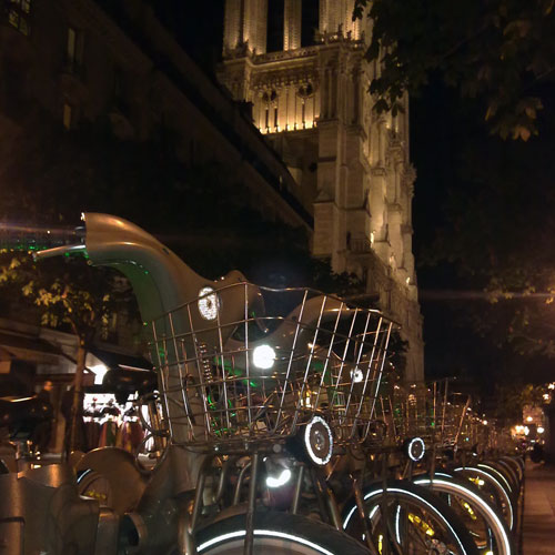
Rental bikes, in front of the Notre Dame cathedral
Adrien Gey presented a circular slow traffic network in the Grand Paris region, connecting various parks and natural sites to housing and work areas. Guowen Dai demonstrated some of the challenges around the new high-speed South Station in Nanjing. An area of 32 square kilometers should become a ‘new town’ of 60.000 people. However, current urbanization has not occured according to the master plan, and integration of the station with metro and road networks will be challenging. Wendy Tan showed that TOD projects all over the world keep track of each other and sometimes copy-paste design solutions from other contexts into their own.
Maria Palumbo analyzed the motor-taxi system in Cotonou (Benin), which is starting to evolve into a formal system by recognizable yellow driver t-shirts. The Cotonou model is being exported to other cities in the West-African region, such as Bamako in Mali. Armando Padilla investigated TOD implementation possibilities in the Alicante province and Murcia region, according to the Dutch Stedenbaan experience. The polycentric region suffers from sprawl and the real estate crisis, which makes improvement of rail transport very challenging.

Juliette Maulat presented metropolitan density targets for a rail corridor west of Toulouse. Between 2000 and 2010 the frequency of the service was raised to 4 trains per hour, leading to an increase in ridership. However, the improvements on the transport system merely supported urban development, and did not shape them to the desired densities. Paul Chorus demonstrated that the Tokyo metropolitan government regulates density and public space around transit stations by granting higher floor area ratios to developers. Transit companies develop diverse activities along a corridor to create off-peak travel and make more profit. The companies gain life-time concessions and thoroughly investigate their territory and residents to optimize revenues.
Elina Krasilnikova and Yulia Ivanitskaya presented the longitudinal industrial city of Volgograd (Stalingrad), with 100km length and 9km width one of the longest cities in the world. A new waterfront transport axis could initiate redevelopment of the industrial sites along the river and make place for a linear park and leisure facilities. Wulfhorst and Alain L’Hostis discussed the German-French collaboration project Bahn.Ville, which was directed at integration of transport and spatial planning at two reference sites: St. Etienne and Thaunusbahn (Frankfurt). Implementation of TOD in Saarterassen, near the French-German border, is still difficult due to sectoral responsibilities and lack of an integrated lobby agent for TOD. Despite these setbacks, they have the following advice: ‘Don’t Wait! The time is now, the place is here! Start testing implementation of TOD right away.’

Photograph of Volgograd, taken from the International Space Station

Read more:
SprintCity planning support tool in Utrecht
Atlanta BeltLine – lecture, debate and booklet
SprintCity – spring 2011

Hong Kong public transport nodes
SprintCity goes China